Two Polish companies are working on AI-based technology for remote analysis of soil parameters with satellite images to help identify the best places for growing crops and reduce the use of fertilizers.
According to the UN Food and Agriculture Organization (FAO), agricultural production will have to increase by as much as 70 percent by 2050 to feed the growing population of people on Earth.
In response, experts from Poland’s KP Labs and QZ Solutions say one of the answers to this challenge is precision agriculture that uses the latest technologies and detailed knowledge on the subject of soils. Automation of planning and decision-making allows to increase the yield and farm performance.
According to them, this will shorten the waiting time for key research results for farmers from 3 weeks to 4 days.
QZ Solutions CEO Zbigniew Kawalec said: “To emphasize the importance of our companies' discovery for the future of agriculture, we decided to call our project Genesis, the beginning. It will be a turning point in a traditional approach to crop planning and become a tool that will revolutionize this branch of the economy in the future.”
The project commissioned by the European Space Agency (ESA) consists of conducting a pilot soil analysis program on using hyperspectral data.
According to the companies, the resolution obtained from samples in the case of satellite and aerial data allows to obtain detailed information that is necessary for further interpretation. A traditional approach to monitoring soil parameters is completely dependent on humans, because soil samples must be collected, mixed and sent for analysis, which takes a lot of time and is very labour-intensive.
The experts said: “The idea of using hyperspectral imaging supported by artificial neural networks will allow to compare the material collected on the site (a traditional method) with that obtained and processed remotely.”
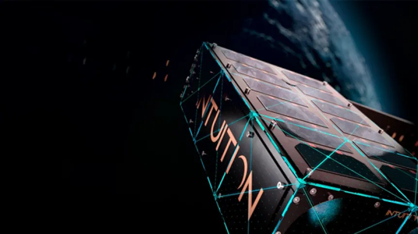
If successful, the next stage of the project which will take place in space where data processing will be done directly in orbit, will be launched. The entire process of detecting soil parameters will be automated thanks to the algorithms present on the Intuition-1 satellite.
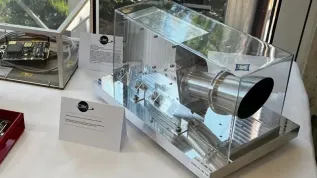
According to the companies’ press release hyperspectral imaging is the key to remote analysis of soil quality and composition. They said: “It consists in gathering and processing information (in the spectrum of electromagnetic waves) that our eyes are not able to register. However, a hyperspectral camera can do this. Thanks to the use of several hundred different spectra, artificial intelligence algorithms can estimate the amounts of individual macroelements in the soil.”
Due to the huge amount of collected data, sending it to Earth would be time-consuming and expensive. Intelligent algorithms will operate in the satellite's computer and will send the results to the ground base.
KP Labs plans to place the intuition-1 satellite in orbit at the turn of 2023, saying that the satellite's capacity for such complicated data processing distinguishes it from other similar systems.
The company’s Director of Operations Michał Zachara said: “The idea of the project is to use our Intuition-1 satellite for this purpose. Plans are very ambitious and we want to first check in a pilot +Earth-based+ stage if it is possible to remotely detect soil parameters using a machine learning to analyse hyperspectral data.”
He added: “If we succeed, we plan to transfer our solution to the Intuition-1, thus proving that the soil parameters can be detected remotely +from space+. Genesis will not only contribute to the development of agriculture, but also prove that machine learning can provide key information from raw hyperspectral data in specialized applications. It will be a huge step into the future of agriculture.”
PAP - Science in Poland, Marek Matacz
mat/ agt/ kap/
tr. RL


