Polish scientists have discovered unknown structures in the Machu Picchu Archaeological Park in Peru by using a laser scanner attached to a drone.
As part of their cooperation with the management of the Machu Picchu National Archaeological Park, a few years ago Polish scientists began research in the 15th century Inca ceremonial complex Chachabamba located in the Machu Picchu Park in Peru.
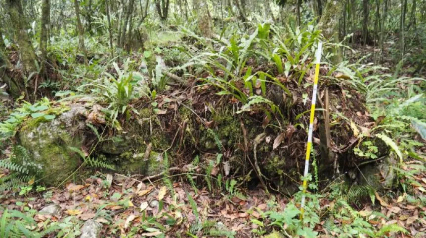
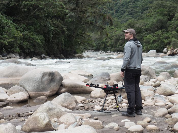
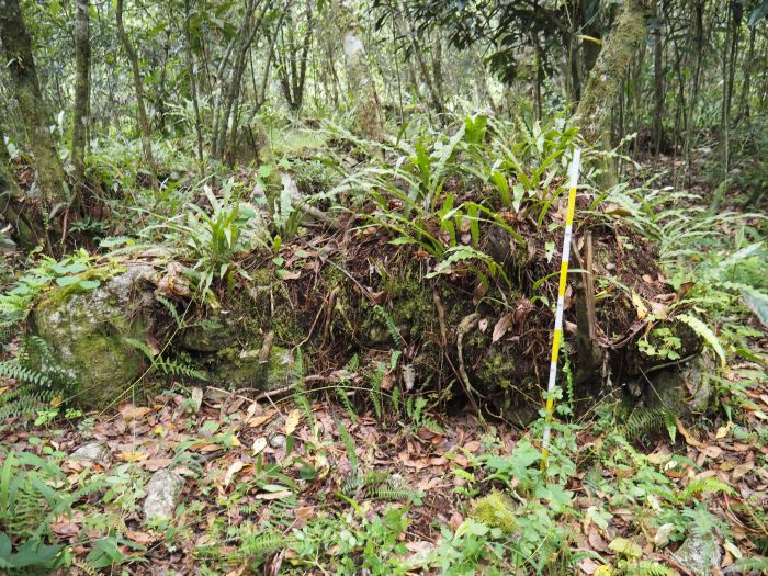
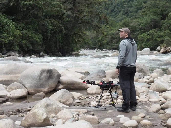
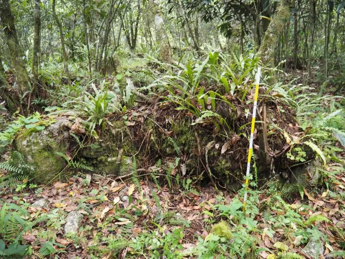
But because most of the area is cover by tropical forest, making research difficult, archaeologists decided to use a drone with a laser scanning device (LiDAR) attached.
This scanning 'removes' trees and shrubs from the resulting image, and prepares a terrain visualization. It was carried out by a team led by Dr. Bartłomiej Ćmielewski from the 3D Scanning and Modeling Laboratory - LabScan 3D at the Faculty of Architecture, Wrocław University of Science and Technology.
Dominika Sieczkowska from the Center for Andean Studies of the University of Warsaw, and leader of the National Science Centre project designed to study the water system in Chachabamba, said the drone enabled them “to detect a number of unknown structures at the site.”
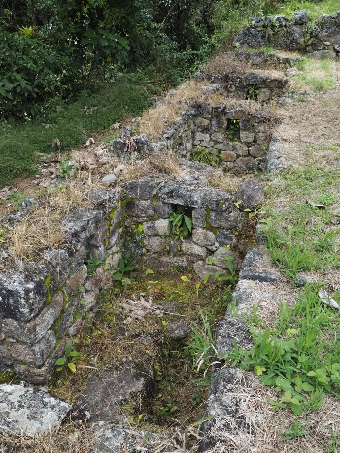
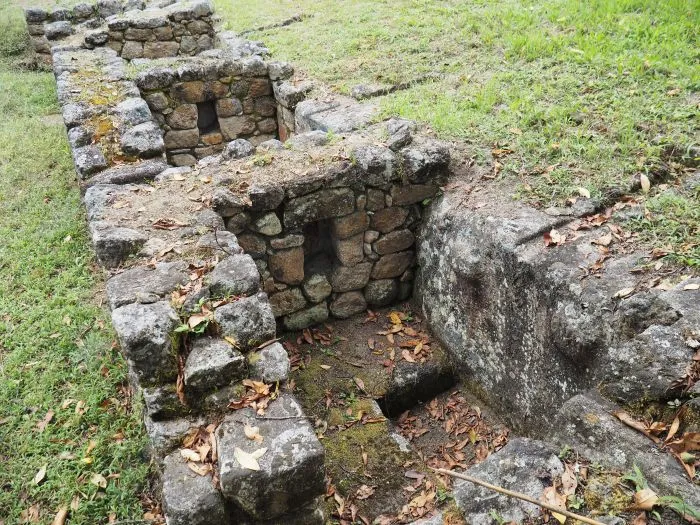
The central part of the ceremonial complex was a large stone with carved altars, stairs and a channel for sacrificial liquids, possibly beverages or animal blood. In front of the boulder was a small square with buildings on both sides, surrounded by a dozen of small ritual baths archaeologists refer to as fountains. They were reservoirs into which water ran down the walls. They were used for ritual ablution.
During the latest research with laser scanning, the researchers also discovered previously unknown parts of the channels that supplied water from the nearby river. Water was supplied to the ceremonial complex in Chachabamba by a system made of stone blocks that run partially underground. After passing through the ceremonial centre, water would flow through a similar drainage system into the river in the valley.
The buildings identified by the researchers were located on the outskirts of the ceremonial complex.
Sieczkowska said: “We have a dozen or so small structures erected on the plan of a rectangle and a circle. We believe that they were staff residences. We will have more information after we manage to carry out excavations. These, however, are now prevented by the coronavirus pandemic.”
But based on laser images, researchers have already concluded that these buildings were built with far less care than the structures in the central part of the site.
According to Sieczkowska, there are indications suggesting that it was mainly women that took care of the complex. They include the items discovered during previous excavations conducted in the area by the Polish-Peruvian team. They are associated with weaving, a craft of women in the Inca state.
The researchers used data from laser scanning to prepare a hydrodynamic model of channels that supplied water to the fountains. This means that, taking into account the slope and the depth of the channels, the researchers virtually 'poured' water into the channels and reconstructed its flow.
Sieczkowska continued: “We were able to determine that channels supplied water not for utility purposes, it had a symbolic meaning, because the channels would not be able to supply large volume, they were not deep and would overflow. This confirms our hypothesis that water had a ritual role in Chachabamba.”
She added that in other places similar analyses were usually carried out in a practical way, by clearing the channels and pouring water into them.
According to the researcher, the hydrodynamic model can be successfully used in other Andean sites, and with small parameter changes probably also in other parts of the world. The model was developed by hydrologists and surveyors from the Wrocław University of Environmental and Life Sciences- Paweł Dąbek, Krzysztof Wolski and Izabela Wilczyńska. Logistic support during the research project was provided by the Machu Picchu park director, José M. Bastante.
The paper describing the latest research (financed by the National Science Centre) appeared in the Journal of Archeological Science: https://doi.org/10.1016/j.jas.2021.105515.
The Machu Picchu National Archaeological Park covers an area of over 36 thousand hectares. It includes approx. 60 archaeological sites, many of which have not been studied due to difficult access and dense plant cover.
PAP - Science in Poland, Szymon Zdziebłowski
szz/ zan/ kap/
tr. RL
Gallery (4 images)
-
 1/4Credit: D. Sieczkowska
 -
 2/4Credit: D. Sieczkowska
 -
 3/4Credit: D. Sieczkowska
 -
 4/4Credit: D. Sieczkowska