The continents are still growing, moving and changing their shapes. Geologists from the AGH University of Science and Technology and the University of Wrocław study the mechanisms of their growth. Ancient islands are still waiting to be discovered. Scientists are tracking the traces of subduction - a process that occurs at the junction of lithospheric plates.
The lands of modern North America and Greenland once belonged to the Laurentia continent, and today's northern Europe - to Baltica; they were separated by the waters of the Iapetus Ocean.
In the Silurian, the two continents collided and subduction took place, a process in which one lithospheric plate is pulled under another. Although this process is very slow, when stresses become too great, energy can be released violently, resulting in an earthquake. The rock material piled up as a result of the collision may, in turn, lead to the formation of mountain ranges, such as the Scandinavian Mountains, geological structures whose shapes are still visible in modern Europe.
Scientists from Dr. Jarosław Majka's team at the AGH University of Science and Technology found traces of several successive stages of subduction throughout the Scandinavian Caledonides.
Team member Dr. Katarzyna Walczak said: 'We started to wonder: why do we see traces of several stages everywhere? We came to the conclusion that perhaps the Iapetus Ocean, which then divided Baltica and Laurentia, did not look like we imagine today's Atlantic Ocean. Maybe it looked more like the area between Australia and Asia? There, we have a lot of islands associated with volcanism and island arcs formed in subduction zones.’
The scientists decided to conduct a more detailed geological study of the prehistoric Iapetus Ocean. The project 'How do continents grow? The Köli Nappe Complex in the Scandinavian Caledonides as a natural laboratory for continental accretion' received funding from the National Science Centre.
Dr. Walczak is its manager, and the team consists of scientists from the Department of Mineralogy, Petrography and Geochemistry of the Faculty of Geology, Geophysics and Environmental Protection of the AGH University of Science and Technology and the Faculty of Earth Sciences and Environmental Management of the University of Wrocław.
Dr. Walczak said: ’First of all, we would like to determine in what environments the rocks formed that were accreted (attached) to the Baltic continent, and in what period of time they were formed.
’The question that arose from the previous project is what this ocean looked like, and what processes took place in it that led to the formation of this new continental crust. We are also interested in the process of formation of these arcs - whether they were associated with subduction, whether they were old fragments of continents or microcontinents.’
The Scandinavian Mountains, formed as a result of the collision of Laurentia and Baltica, have a similar origin to the Himalayas and probably once resembled these currently highest mountains also in appearance. However, over millions of years, they have eroded away and are now much lower. This is a significant convenience for researchers.
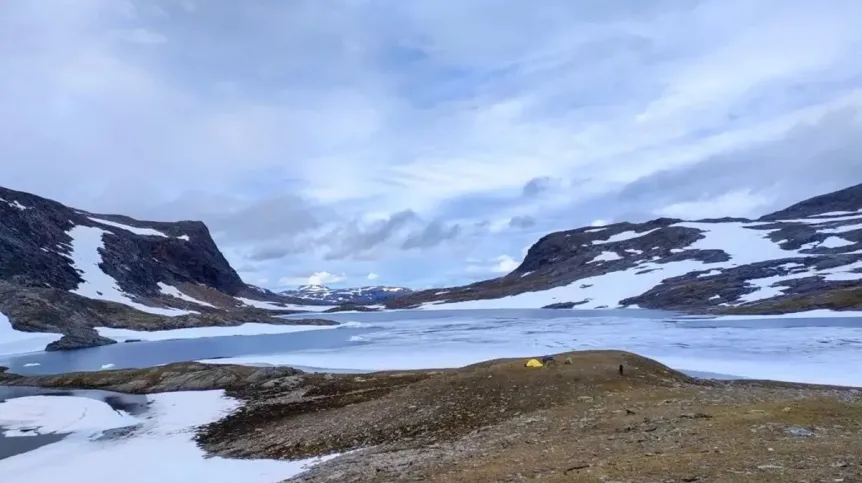
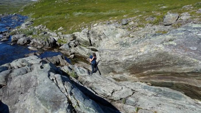
Walczak continued: ‘Thanks to the fact that this orogen is eroded, it is as if someone cut through the Himalayas and allowed us to look inside. From a geological point of view, access to these rocks is easy. Moreover, especially in northern Scandinavia, vegetation cover is so sparse that these rocks are relatively well exposed.
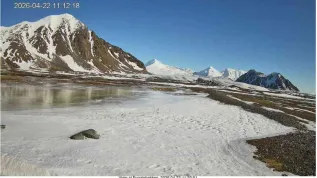
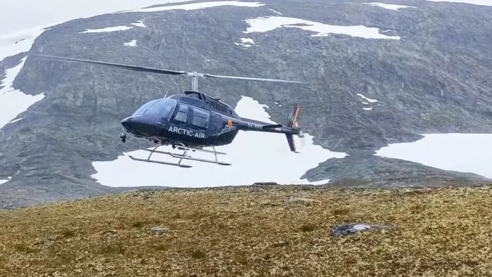
‘We do not have to look for them or dig up to them, we can go there, take a sample, see the relationships between individual rocks. However, access to the areas themselves is often difficult, because many of them belong to the Saami - native inhabitants of northern Scandinavia, who herd reindeer there and are reluctant to invite strangers. There are no paths or roads - we often work in isolation, far in the mountains.’
The geologists are trying to reconstruct the course of processes on the basis of discovered traces. Even if they study current processes, they cannot observe them directly, because these processes are happening so slowly and on such a large scale that it is impossible to see them with the naked eye (continents, for example, still move a few centimetres a year).
Walczak said that the 'new' rocks of the continents are formed mainly over subduction zones, where the thinner, denser oceanic crust penetrates back into the Earth's interior, where it is melted, and the resulting magma migrates towards the surface, creating igneous rocks. These processes can be observed in volcanic chains called 'island arcs'. Continents grow in size by successively attaching volcanic arc rocks to their edges in the process called accretion.’
Although most of the continents are cratons (the most hardened, oldest fragments of the continental crust, characterized by high stability), the growth of continents in subduction zones is by no means a marginal part. These can be hundreds of square kilometres of surface, often rich in deposits of valuable metals.
'Australia is moving north and will eventually dock with Asia. Then all the island arcs currently north of it will be incorporated into the continent, they will be pushed onto the continent. And with them, fragments of the ocean floor and the sediments that accumulate on the ocean floor will be pushed. Then the continental crust will be not only Asia and Australia, but also everything between them. A similar situation must have also occurred at the junction of Laurentia and Baltica, in today's Scandinavian Mountains,’ Walczak said.
Scientists use methods related to geochronology, geochemical research, supplemented with isotope analyses, also in zircons. Zircons are very resistant minerals that are formed by crystallizing most often from magma, then they 'survive' the erosion of these rocks, are deposited in sediments, and later these sediments can be metamorphosed, remelted or metamorphosed and remelted. Zircons can therefore contain a record of several geological events.
Dr. Walczak said: ‘Geochemical studies of rocks attached to Baltica were mainly carried out almost 40 years ago, and so far few advanced, modern geochemical and isotope studies have been performed, which could provide more details on the sources of igneous rocks and the processes in which they were formed. Hence our plan to use such methods to determine the formation time and environment of the Iapetus lands, their evolution and accretion. We hope that a modern approach to the problem will allow us to obtain a much more complete picture of the tectonic processes leading to the formation and growth of the new continental crust.’
Find out more about the conditions of research work, expedition planning and detailed methods used in geological research - in the source article. (PAP)
PAP - Science in Poland
kol/ bar/ kap/
tr. RL