Salty and polluted soils, lack of water, strong sandstorms make the areas of the dried-out Aral Sea a hostile ecosystem. Scientists from the University of Warsaw will help stabilise the desert area, restore vegetation, and retain those inhabitants who still remain there.
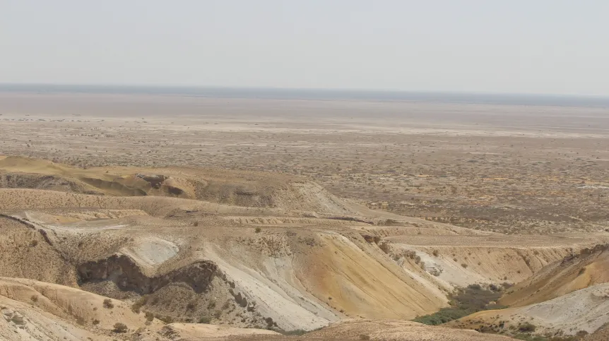
A new ecosystem called the Aralkum Desert with an area of 3.2 million hectares has formed in the area of the almost dried-out Aral Sea and the deltas of the rivers that used to supply the sea: the Amu Darya and the Syr Darya.
This area, located in Uzbekistan and Kazakhstan, is struggling with many problems, such as significant variability of the salt content in the soil, water shortages, which means that it is difficult to maintain any vegetation. In addition, there is significant environmental pollution and a growing number of extreme weather events caused by desertification.
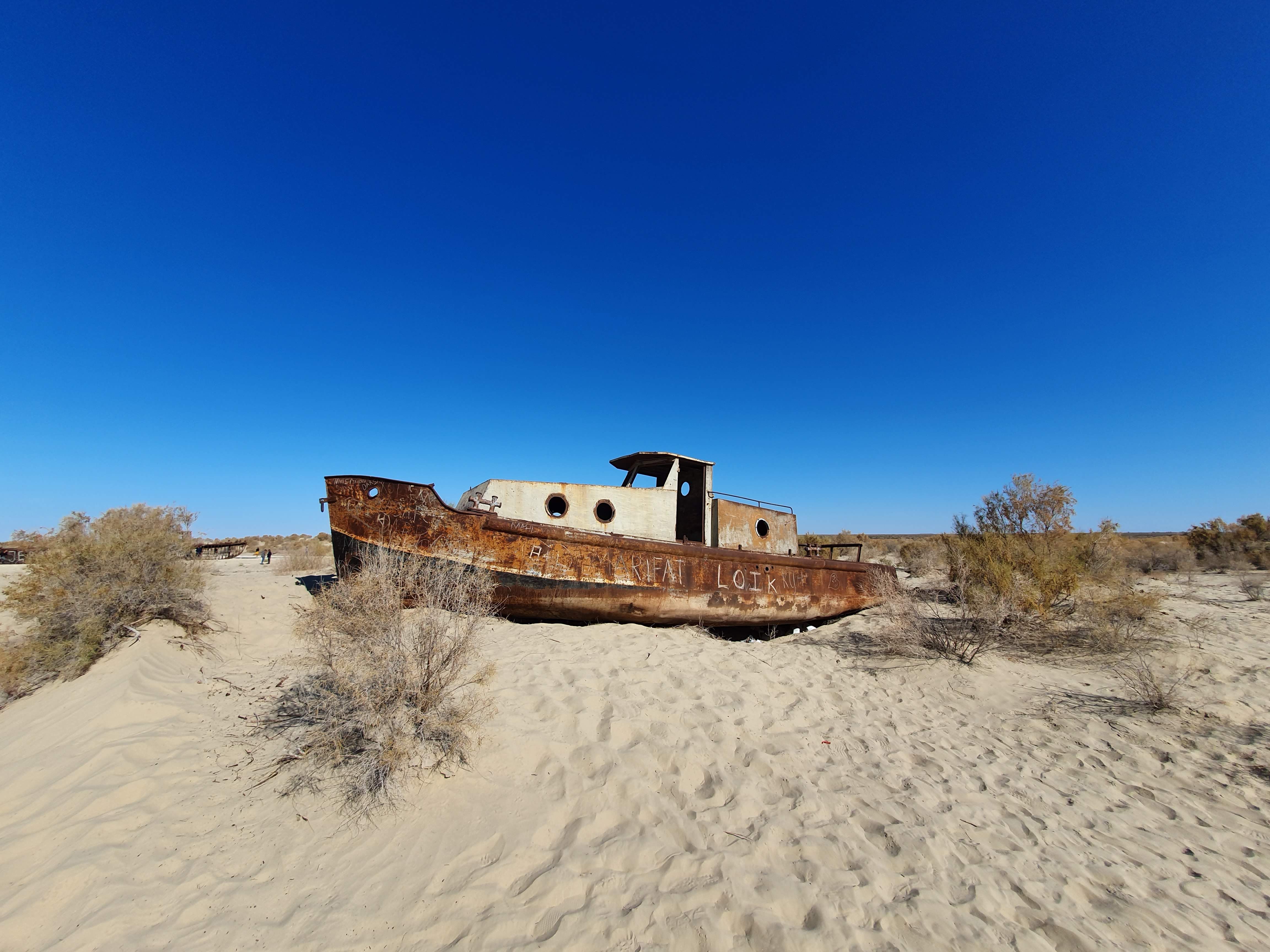
'All this means that this was once one of the four largest inland lakes in the world, a huge source of drinking water and an area where in the 1960s about 40,000 people worked in the fishing industry, breeding sturgeon, has become inaccessible, hostile to life for people, animals and plants', says Professor Małgorzata Suska-Malawska from the Faculty of Biology at the University of Warsaw.
Professor Suska-Malawska and Professor Bogusław Wiłkomirski from the University of Warsaw Biological and Chemical Research Centre, in collaboration with scientists from the National University of Uzbekistan, will participate in research on the reclamation of the newly formed Aralkum desert ecosystem. The aim of the project is to restore part of the vegetation, counteract erosion and stabilize the desert substrates. The project is financed by the Agency of Innovative Development of the Republic of Uzbekistan.
As a result of irrational management of the waters of the rivers that supplied it, conducted in the times of the Soviet Union in Uzbekistan, and other complicated political issues, the Aral Sea has already dried up by 80 percent in relation to the area it occupied in the 1950s. The drying process, spread over about 70 years, began in the 1960s and ended in the early 21st century.
'In the 1980s, it was noticed that the water supplies from the two rivers Amu Darya and Syr Darya, feeding the Sea, did not balance evaporation. These rivers were intensively exploited primarily for irrigation of cotton fields in the oxbow lakes of the Amu Darya and Syr Darya', says Professor Suska-Malawska.
Currently, the Aralkum Desert, which was previously the bottom of the Sea, and the dried-out areas of the former Amu Darya delta are a diverse geomorphological and geochemical mosaic of saline soils that have formed in these places, because salt has accumulated over the years. From the chemical perspective, as the scientist explains, apart from sodium chlorides, it mainly consists of magnesium and calcium carbonates and sulphates.
'In the Aralkum Desert, we have highly saline sediments from the bottom of the lake, river delta areas, oxbow lake areas, which are now swamps often covered with a two-centimetre layer of salt. In the past, the Aral Sea was called the Lake of a Thousand Islands due to the numerous islands that, depending on the water level, protruded more or less above the water surface. Now that the waters have dried up, we are dealing with a very undulating terrain', Suska-Malawska says.
Plague, DDT and sandstorms
The matter is further complicated by the fact that during the heyday of the Aral Sea, one of the largest islands (Vozrozhdeniya Island) was a military testing ground for biological weapons of the Soviet Union.
'Research was conducted there on pathogens such as smallpox, plague, anthrax. The Russians buried this arsenal, but when the lake dried up, the island connected with the mainland. This area was not protected in any way, and many biological substances leaked into the environment', Suska-Malawska adds.
As if that was not enough, for several decades the Amu Darya River also carried many chemicals used in agriculture, including cotton cultivation: DDT, which was commonly used there, as well as other very aggressive pesticides, defoliants, heavy metals.
In the past, the lake was also an important element stabilising the climate, and its drying out resulted in an intensification of extreme weather phenomena. The worsening climate in Uzbekistan has caused severe sand and dust storms that reach as far as Tashkent, more than 1,000 kilometres from the Aral Sea.
'Since most of Uzbekistan is desert, we have a huge risk of dust collecting salts, which in themselves pose a threat to people, but also all the pollution associated with activities on the testing grounds and with cotton cultivation. All the dust that blows around this plantless area carries both what nature has given and what man has added', says Professor Suska-Malawska.
The environmental disaster, which reached its peak in the 1990s, naturally had a huge impact on people. It particularly affected the Karakalpaks, an ethnic population living on the north-eastern side of the Aral Sea. Residents began to suffer massively from cancer, kidney failure and respiratory diseases, and the region recorded one of the highest infant mortality rates in the world. As a result of these tragic conditions, there was an exodus of residents from these areas.
Trees in the desert: conclusions from a failed experiment
As a result, Uzbekistan took action supported by international funds from the World Bank to stabilise these areas, the raging sands and dust. An attempt was made to reforest the bottom of the Aral Sea by planting 100,000 trees. Most of them did not survive, they could not withstand extreme salinity and lack of water.
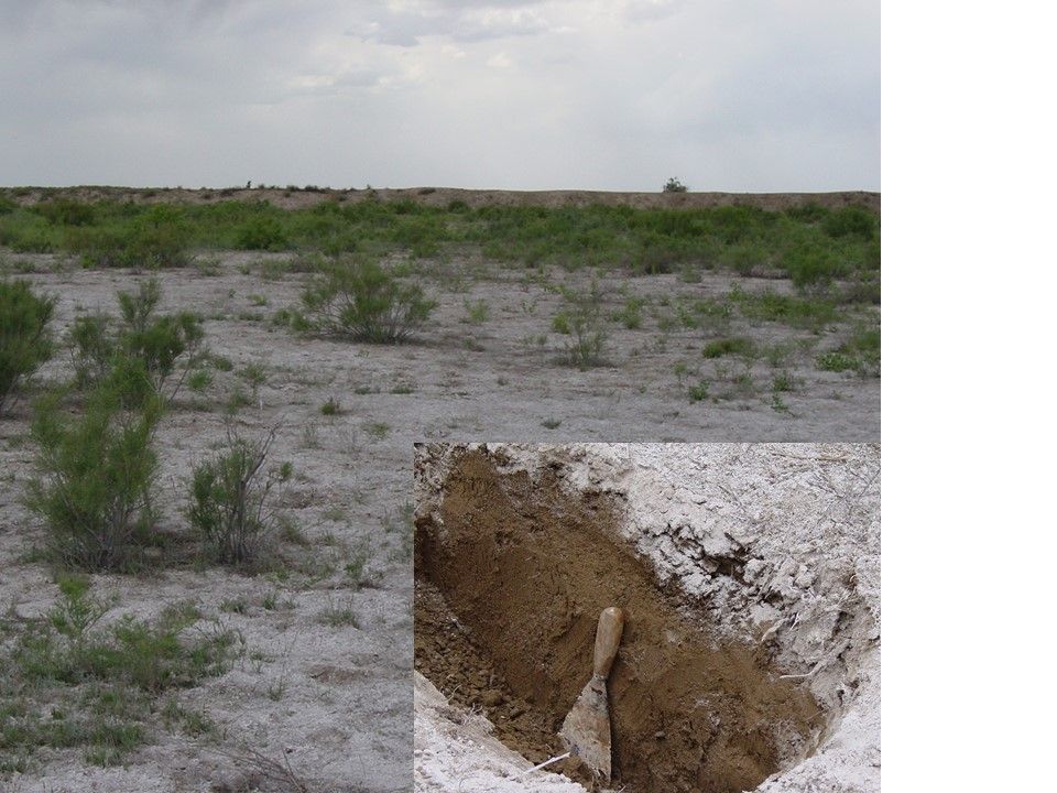
'So the idea was born that before planting anything there, one must understand the geomorphological and geochemical diversity of this place very well, because plants react differently to different types of salinity: chloride, sulphate, carbonate. This is where the idea to develop geochemical maps of the Aralkum desert soils came from', Professor Suska-Malawska says.
Five representative experimental fields for salinity types were distinguished, with different surface features, different types of soil, and above all, different geochemical substrates. Very precise geochemical studies will be conducted on them, related not only to the salt content, but also to the content of microelements and trace elements. Scientists will control the dynamics of changes in salinity during the year, because it is the fluctuations in salinity during the growing season that have an adverse effect on plants.
Simultaneously, experiments will be conducted in greenhouses to grow plants in different types of salinity. Gradually, these plants will be introduced to the aforementioned experimental fields, where they will also be subject to constant monitoring.
Smart afforestation
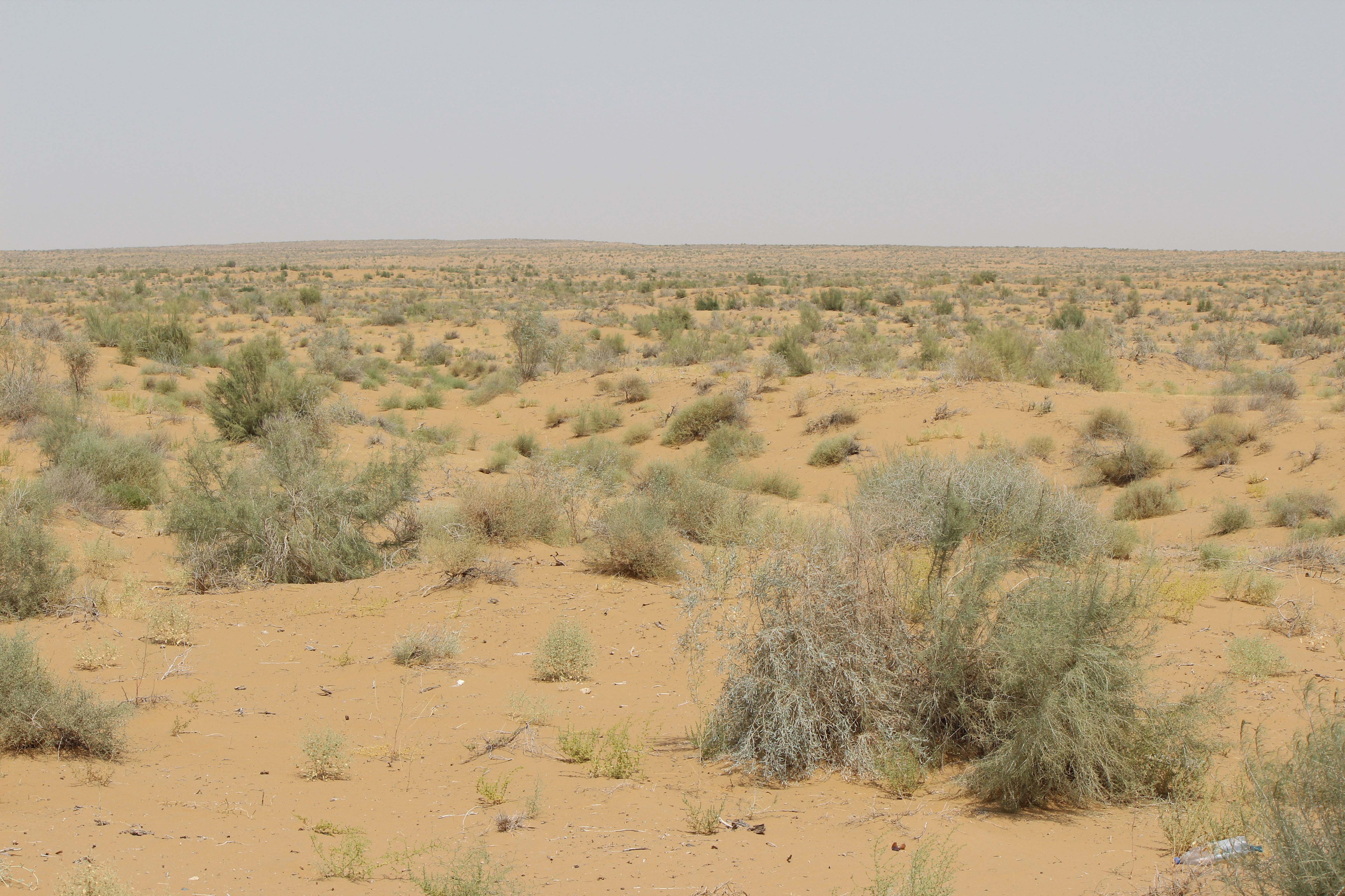
'You could call it smart afforestation. It is primarily about stabilizing the soil and introducing plants resistant to salinity of various types, mainly halophytes, which have naturally evolved to live in a highly saline soil', says Professor Suska-Malawska.
These are primarily two species that grow in most deserts in the world. The first are tamarisks, which absorb salt water so that the secreted salt crystallises on their stems and leaves.
The second species are saxauls - plants of Asian deserts, adapted to significant fluctuations in temperature, salinity and water deficits, which have very long root systems that reach groundwater. Their root mass and trunk mass are compact structures soaked in oils. For this reason, they have been used as fuel since ancient times, which contributed to their disappearance in many places of the Karakum and Kyzylkum deserts. They are one of the species that will be restored there.
In turn, the delta of the dried-up Amu Darya used to be home to species-diverse riverine forests called tugai with numerous poplars. In these places, poplar will be planted, along with useful plants.
'This is because the second goal of our project is to introduce useful plant species, such as alfalfa, to support the local population', Suska-Malawska adds.
***
The three-year project 'Establishing Scientific Criteria for Classifying Plant Cultivation Zones Based on Physical, Chemical, and Biological Soil Characteristics in the Aral Sea Basin' is a continuation of over 20 years of cooperation between the University of Warsaw and the National University of Uzbekistan.
PAP - Science in Poland, Ewelina Krajczyńska-Wujec
ekr/ agt/ kap/
tr. RL