Scientists are now able to check how the ice mass is changing in Greenland and Antarctica, where measuring instruments cannot be installed. The new method involves determining changes in the Earth's shape based on observations of anomalies in the movement of artificial satellites and 'orbit memory'.
The results of the Polish-Swiss team have been published in the journal Remote Sensing of Environment. The co-author of the paper, Professor Krzysztof Sośnica from the Wrocław University of Environmental and Life Sciences, talks to PAP - Science in Poland about a new method for determining the change in ice mass in circumpolar regions. The first author of the publication is doctoral candidate Filip Gałdyn.
ANTARCTICA AND GREENLAND - STABLE ONLY UNTIL 2000
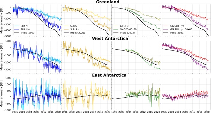
The method of splitting and re-stacking of normal equations allowed to determine changes in ice values in the year 1995-2022.
'It turned out that in the years 1995-2000 there were no major changes in Greenland and West Antarctica. After this period, the ice loss was progressing faster. In Greenland, the years 2010-2015 are characterized by the greatest loss of ice mass. The ice loss process slowed down in 2015-2019 and then accelerated again, which we are currently observing. East Antarctica is gradually accumulating ice, but it is happening so slowly that it does not balance the loss of glaciers in other regions,’ says Professor Sośnica.
TWO SATELLITES MEASURE CHANGES IN THE SHAPE OF THE EARTH
Access to the areas of central Greenland and Antarctica is so difficult that it is hard to determine the loss of ice mass in those areas, say scientists from the Institute of Geodesy and Geoinformatics at the Wrocław University of Environmental and Life Sciences.
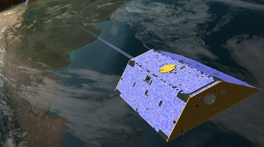
Satellite missions come to the rescue, including the GRACE mission, which uses a pair of satellites that measure the distance between each other.
'When there is a gravitational anomaly in the form of a larger mass under one of the satellites, the satellite is attracted more strongly, which changes the distance. Then, the second satellite flies over the same area, experiencing acceleration and a change in position, which is recorded by the GPS receiver and an interferometer used to measure the distance between satellites,’ says Sośnica.
The GRACE mission was launched in 2002. Little is known about changes in Earth's mass and gravity before that time. This mission ended when the first satellite burned up in the Earth's atmosphere on December 24, 2017, and the second one on March 10, 2018.
The GRACE mission is continued by a constellation of two twin satellites - GRACE Follow-On, launched in 2018. They continue to measure the Earth to this day. However, there was a one-year gap in data on gravity changes: at the turn of 2018.
NEW METHOD WILL EXPLAIN WHAT HAPPENED BEFORE AND FILL THE GAPS
Researchers from Wrocław, together with scientists from the University of Bern in Switzerland (Institute of Astronomy), decided to estimate mass changes on Earth before the launch of the GRACE mission and supplement the missing data between GRACE and GRACE Follow-On.
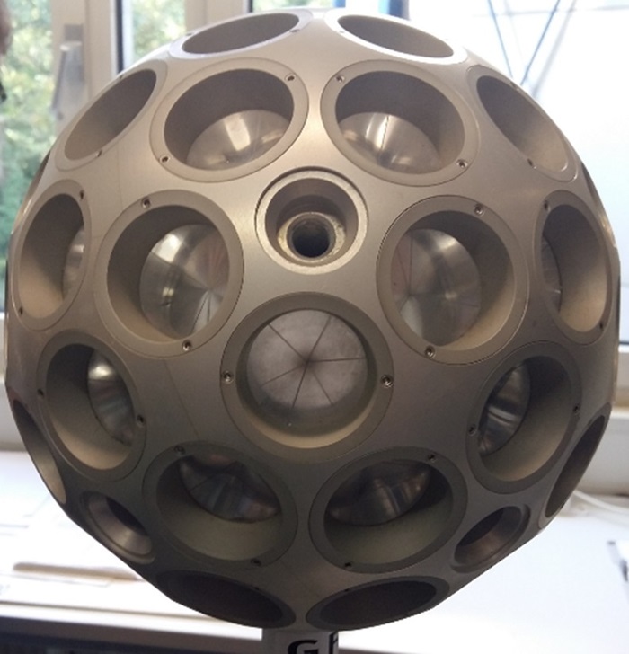
To that end, they used spherical satellites that have been orbiting the Earth since the 1970s. The motion of a spherical satellite is disrupted when it passes over an area of high or low mass. The satellite's prisms reflect the laser light in exactly the same direction as the incident beam. This allows scientists to measure their position from Earth using laser rangefinders.
USING THE 'ORBIT MEMORY' OF SATELLITES
There is not a single laser station measuring distances to satellites in Greenland and Antarctica. Therefore, anomalies in the satellite's position caused by ice mass loss cannot be directly measured there. The Polish-Swiss team proposed to use 'orbit memory'.
'When a satellite flies over a given area of unusual mass, it changes its orbit. Based on subsequent and earlier distance measurements, it is possible to determine where and when the orbit changed and how large the mass on Earth was that caused the orbit change,’ says Professor Sośnica.
He adds that one satellite is not enough to determine the exact time and place and the value of mass on Earth that caused the change in the object's trajectory. A satellite's path change can be caused by various things, such as air resistance or solar radiation pressure. However, observations from many satellites allow to clearly determine the cause of the change.
Models of the Earth's shape changes have been published on the International Centre for Global Earth Models (ICGEM) platform.
PAP - Science in Poland, Karolina Duszczyk
kol/ zan/ kap/
tr. RL