No effort required: just a photo of plastics collected by the river and a photo of the surrounding vegetation. Anyone interested can help scientists create a map of macroplastic pollution of mountain rivers, says the initiator of the campaign, Dr. Maciej Liro from the Institute of Nature Conservation PAS.
Macroplastic pollution threatens water resources, biodiversity and recreational values of mountain rivers, Dr. Liro tells Science in Poland (Nauka w Polsce). Together with his colleagues from the institute, the scientist had previously described the problem of river pollution with macroplastics.
Ultimately, it would be good to combat the problem and limit the associated threats. First, however, it is necessary to determine where the most macroplastics accumulate in the river.
Scientists have an idea to involve 'ordinary people' in identifying the most polluted spots. 'The use of citizen science, an approach that involves volunteers who are not specialists, for example teachers and students or other interested people, in scientific cooperation, provides an opportunity to collect information about this problem at various spatial scales, e.g. a commune or a river catchment,’ says Dr. Liro. He adds that people who come into direct contact with the issue of pollution will become more aware of the importance of this problem.
Dr. Liro is running the campaign as part of a citizen science project: he invites people to photograph garbage visible to the naked eye (macroplastics) lying in mountain rivers.
All you need to obtain information about macroplastic pollution in a mountain river is an ordinary smartphone. In total, a participant should take a maximum of 6-8 photos.
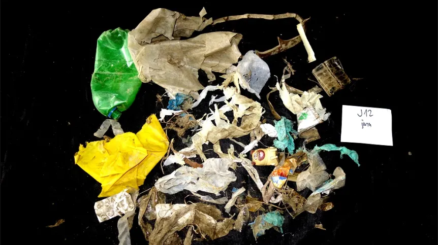
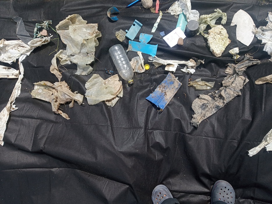
'Documenting the amount and type of macroplastic involves taking two photos: the first, showing the surface itself - and the second, showing macroplastic collected from 10 square meters of the surface', explains the researcher.
Scientists propose documenting garbage on several types of river surfaces. Distinguishing between them should be easy, even for laymen, says Dr. Liro. He lists four types of surfaces. The first is a sediment not covered with vegetation - in practice, it is a gravel or sandy river bank. The second type of surface is herbaceous vegetation, i.e. all plants without woody stems.
The next type is an area covered with trees and shrubs, for example a willow forest covering riverside areas. The last type are surfaces covered with wood debris, i.e. fragments of dead trees and shrubs.
'First, mark an area of 10 m2 (for example, a 2 m by 5 m rectangle or a circle with a radius of about 1.8 m). Then, put on gloves and collect the macroplastics visible within its boundaries. Place the collected garbage on a uniform background. Place a pen, ruler or another object within the frame - during further analyses, it will give researchers an idea of the size of the macroplastics. Upload two photos taken using an online form for each examined surface,’ Dr. Liro says.
Photos should be sent via the online form.
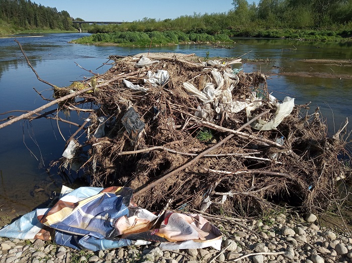
After sending the photos, the participant will see on the map both their own photos and photos of garbage taken in other places, by other users.
Why do scientists pay attention to the river's surroundings? According to previous findings of researchers from the Institute of Nature Conservation PAS, relatively more plastic should be found in the vicinity of large human settlements at the bottom of river valleys, especially in those sections of the riverbed where there are overgrown islands and woody rubble. It is important to confirm where plastic is most likely to accumulate in the river and where it can be removed most effectively.
'We hope that the photos will show where plastic accumulations occur in mountain rivers, which will help local governments choose an appropriate strategy for cleaning mountain rivers,’ Liro says.
Research related to such campaigns can help select places for cleaning rivers - or installing plastic removal infrastructure.
Dr. Liro adds that the main goal of the method and citizen science is to collect information by engaging ordinary citizens, not just experts. 'By encouraging teachers, and through them also children, to perform such measurements, for example during a school trip, we can arouse their interest in the problem. In the future, this will facilitate dialogue between scientists and the public and enable easier development of practical solutions to the problem,’ he says.
A detailed description of the instructions for people who want to take part in the project - e.g. natural sciences teachers, ecological organizations and local government organizations - is available here.
PAP - Science in Poland, Karolina Duszczyk
kol/ zan/ kap/
tr. RL

